
Keeping It Straight
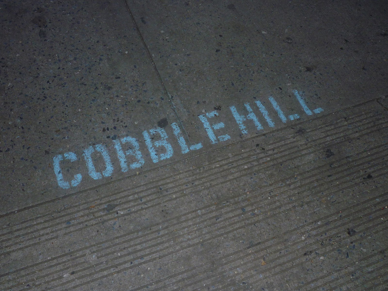
Somebody, I don't know whom, snuck out one night and spray-painted stencils saying "Cobble Hill" and "Carroll Gardens" on either side of DeGraw Street, along Court Street, to designate where one Brooklyn neighborhood began and the other ended. DeGraw, of course, is the dividing line between the two nabes, though not everyone knows that.
"Cobble Hill" is painted on the northwest corner of the intersection, "Carroll Gardens" on the southwest. I love exact neighborhood demarcations, so whomever did this act of random street art has won my support.

![]()


4 comments:
Where does Carroll Gardens end and Red Hook begin?
And were does Cobble Hill end and Red Hook begin? Flickr automatically tags anything west of the Ditch and north of something (I've forgotten - Degraw?) as Cobble Hill, while I would have called it Red Hook. Then again, I thought Union Street was CH, CG border.
Nice post.
This is a controversial matter. The modern demarcation between Red Hook and Carroll Gardens seems to be Hamilton Avenue. But old times will tell you that the street above Hamilton west of the BQE used to be thought of as Red Hook. The line is not as clear as that between CG and CH. Then there's the dividing line between CH and Boerum Hill--another subject of debate. Court Street? Smith Street? People argue.
How about Cobble Hill/Boreum Hill and more importantly Clinton Hill/Bed Stuy?
Post a Comment